7.4.4 Airborne measurements
Larger volume crystals (∼4 L) NaI(Tl) and arrangements of multiple detectors have been used for airborne surveys in support of uranium and other minerals exploration. The systems are installed in aerial platforms in combination with geo-referenced instruments for dose rate and gamma spectroscopy measurements over large areas.
In airborne gamma ray spectrometry the height of the detector above the ground has a large effect. Non-radioactive overburden, as well as dense vegetation, can significantly reduce the radiation output from the earth's surface will have producing the same effect. Snow cover can significantly attenuate radiation from the ground.
Topographic effects can be severe for both airborne and ground surveying. Both airborne and portable gamma ray spectrometers are calibrated for a 2π surface geometry. Field estimates of the radioelements concentrations are thus based on the assumption of a 2π source geometry. Where there are deviations from this assumption, concentration estimates will be in error. Portable spectrometer readings taken in creek beds where there are steep banks or in road cuttings will give completely erroneous results. Similarly, airborne readings in valleys or on the crests of ridges will be in error.
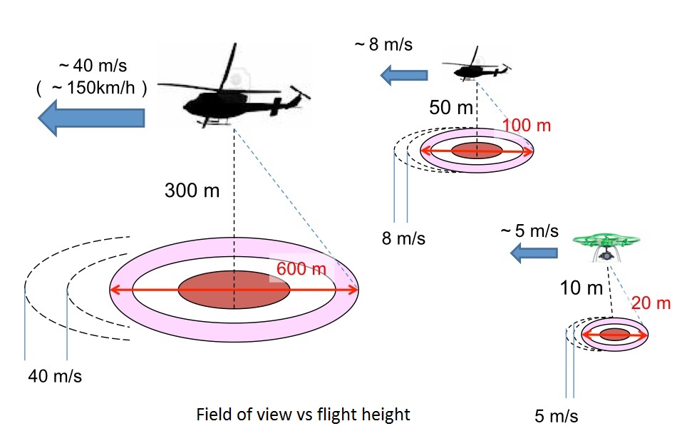
The field of view depends on the altitude of flight, as well as on the speed of travelling. Flights at high heights are usually carried to produce large area maps in geological exploration or to reveal the extent of radiological contamination after accidents. The identification of high spots requires of lower height flight surveys.