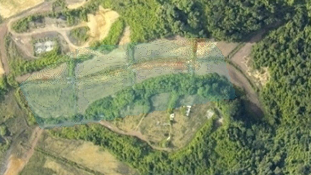
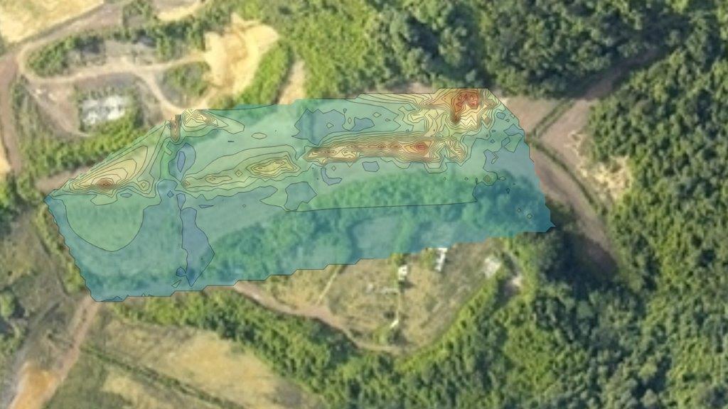
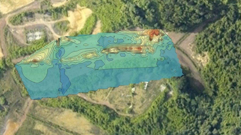
6. Integration of GIS information into the measurements
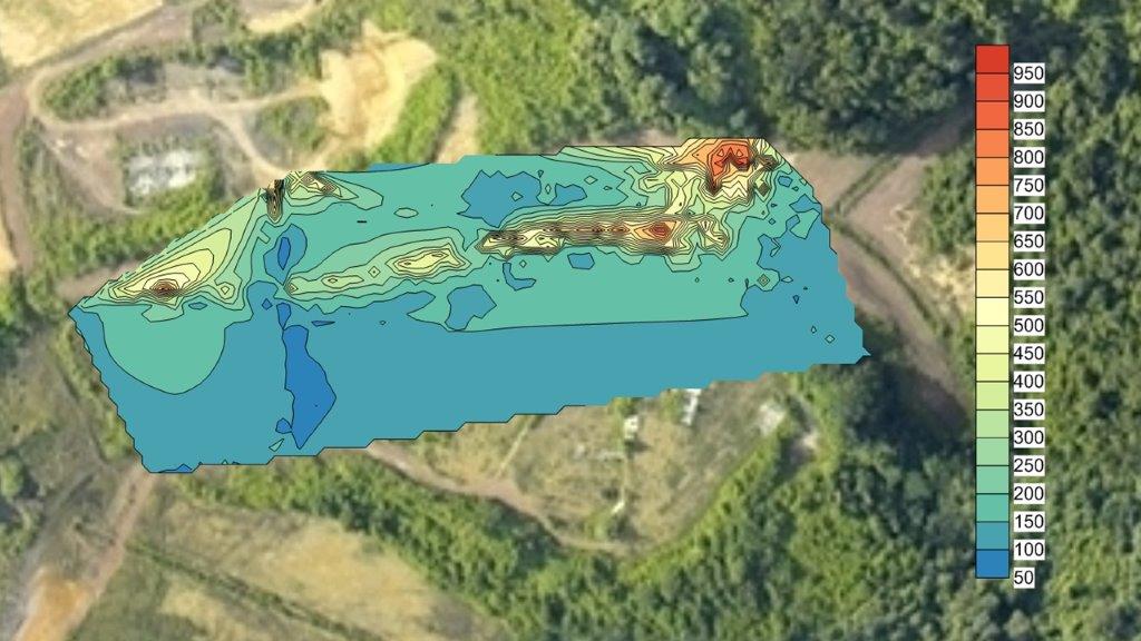
Plotting of data as maps or cross-sections is the traditional means of representing geological and geographical data. It is critical to distinguish between the factual or raw data (postings) and derived or interpreted representations of the spatial character of geochemical data. Contouring, coloring and shading can both illuminate and mask relationships in the data.
Geographic Information Systems (GIS) have proven the potential to provide considerable aid in spatial data analysis. When in-situ measurements are made with geo-referenced stamps, the results can be used to produce maps depicting the spatial distribution of the pollutants