7.5.2 Calibration of map coordinates
In the event that more than one instrument is used, it is advisable to compare the GPS readings across the instruments at selected spots. In case of noticeable differences, the coordinates can be re-scaled as to re-locate into the same positions in the maps.
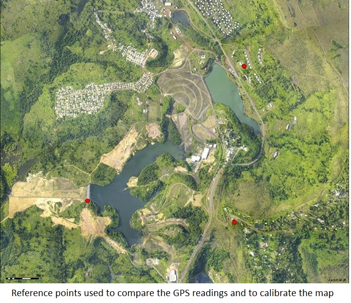
In the absence of good quality geo-referenced maps, aerial photographs can be used. Measurements of the GPS readings must be performed at locations than can be later easily identified in the photographs or in the unreferenced maps. The images can then be re-scaled from pixels to GPS coordinates.